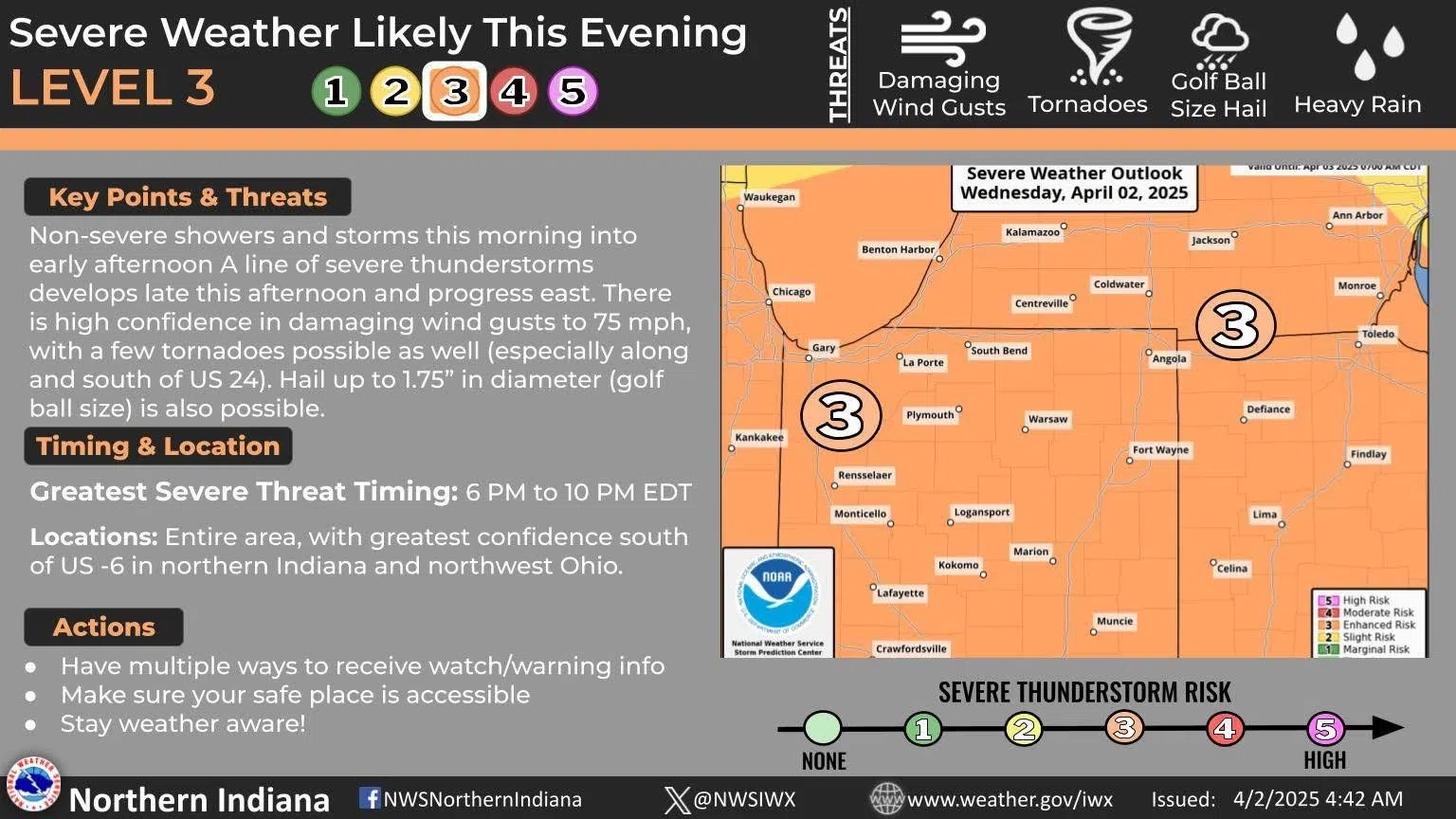
COLDWATER, MI (WTVB)- The first of two rounds of storms rolled through Branch County this morning with continuous thunder, frequent lightning and a steady rain, with some areas receiving between three quarters and an inch between 5 to 11 a.m.. For the 2nd round this afternoon the National Weather Service has placed Branch and surrounding counties in an enhanced risk (3 out of 5) for severe weather, with all threats on the table, including damaging winds, large hail, and flooding rains. They also say a few isolated tornados aren’t out of the question.
The NWS says it’s possible the rain this morning could reduce the threat of severe weather, but it could also be easily enhanced by any afternoon sun.
Several tornados touched down on Sunday including 5 in SW Michigan and at least 3 in northern Indiana.
Stay with am 1590 and FM 95.5 FM WTVB throughout the day for the latest weather information.


Comments