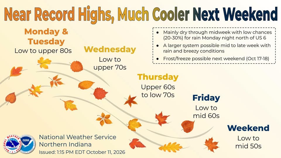
COLDWATER, MI (WTVB) – Coldwater is bracing for a dramatic weather roller coaster this week, starting with summer-like warmth before a powerful cold front sends temperatures plummeting.
Early to mid-week twmpretures will feel more like summer than mid-October, with afternoon highs soaring comfortably into the low 80s.
This unseasonable warmth will put local climate history to the test, drawing attention to the area’s long-standing weather records .
According to the Global Historical Climatology Network daily, the record high temperature for Coldwater on both October 12 and October 13 is 88°, which was set nearly a century ago in 1930.
The summer preview will come to an abrupt halt by the end of the week as an intense cold front sweeps through southern Michigan.
We will make the transition from shorts to heavy jackets practically overnight, as daytime highs fall sharply the 50’s and overnight lows drop into the low to mid 30’s by Friday night.
That transition to the cooler weater will also bring a chance of rain and storms Wednesday and Thursday.




Comments